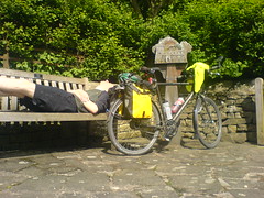
Only for a few minutes, but there was definite sun! 🙂
Category: Uncategorized
Whole lot of nothing
After yesterday’s metropolis-avoiding route, today is pretty much due north. There doesn’t appear to be anything around except the tiniest of villages for the first 30 or so miles. Makes me glad i have a good toolkit with me! But it looks like a shorter day distance wise because i did a wee bit extra yesterday.
My road map doesn’t show contours, only peaks. But I can get an idea of where the slopes must be by looking at where the rivers run. They start out small and separate, and tend to join and grow and gain names as they head downhill.
More shower today, but a strong tail wind too. 🙂
Bashall Eaves
Half way! Woo! *does dance*
Gps says 498.5 miles done, and the afternoon was a pretty relaxed affair up until about 4pm. Now, i suspect that tectonic plates may be reading my blog because, having stated earlier that today looked flat, i discovered some hills of cornwallian proportions towards the end of the day. Not very high or long, but steep with lots of up and down (yes, cyclists really do have 57 different words for ‘hill’).
The route directions also got a bit terse after Mellor and suddenly i realised i was on the wrong road and needed to risk the A59 for 5 miles to get to Whalley. Well, with a nice smooth road surface, adrenaline from being annoyed by the extra miles late in the day, and some additional motivation provided by large lorries whizzing by, i blasted along at 25mph. Upon reaching Whalley, i quickly stocked up on snacks for the evening and looked skyward to see a huge band of dark clouds overhead. And so the last 5 miles out to the bnb in Bashall Eaves were also rather frenetic. But i’m here now!
If you check the Wikipedia entry for this place, it includes a phonebox in it’s top 5 ‘things in Bashall Eaves’ list. So, not much here. And unexpectedly the pub is shut. Apparently they do this on mondays! So delivery pizza it the only option tonight. Getting evening food is turning out to be a bit of a challenge on many days!
Goose foot lane
Goose foot lane goes down a steep hill. Prewarned, i was on the lookout for geese. Didn’t expect chickens to be in the middle of the road though! Nearly caught myself a snack!
Manchester canal toll bridge
A wierd anachronism, a toll bridge cross the canal which costs 12p for cars to cross. I wonder how long ago the cost was last changed!
I’m about 5 miles before Chorley. Been dodging black clouds all morning but happily never got very wet. I’ve ducked into a pub for lunch to avoid the latest rain cloud. The roads have been fine, despite the scary motorway laced appearance of the map.
My right knee started getting a bit sore yesterday. I think i twisted it slightly when i was changing down gears and went down one too many. Plus the roads have been a bit rough at times. If you hit a bump just at the wrong point of the pedal stroke, your joint gets a knock. So i ended up taking ibuprofen for the first time and have been fine since.
I’m kinda enjoying this phase – by the end of the day I’ll be halfway. I’ll be one day away from Kendal, which is the start of more familiar territory for me. Then one more day sees me in scotland! Yay!
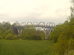
M6
The over way to do lejog i guess! Early on today i got a good view of the landscape ahead, and was pleased to see a complete absence of hills.
Aston-juxta Mondrum
I’ve seen a lot of weird place names on my travels but Aston-juxta Mondrum is the current winner.
Today started at ironbridge with a pretty steep climb up out of the gorge, but after that it was very flat with a tail wind. Gps said 51 miles, ctc route says 57. I had the gps on battery saver mode and it lost reception a few times in the rain. Either way, 3h44 pedalling, 1h lunch, and 30mins sheltering from rain. Arrived at bnb at 3pm, all admin done by 5pm and i’m having a relaxing time. The weather forecast was spot on – rain in morning, dry at lunch, heavy rain later. I arrived just as the later rain started, phew. Rain at the end of the day is a big deal because you have to dry all your gear overnight.
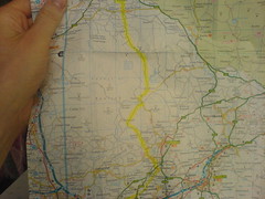
I just checked the map, and i’m nearly at the top of wales! Tomorrow’s map page is full of colored ink – manchester and motorways everywhere, but hopefully that’ll keep the traffic off the wee white roads i ride on.
Into Cheshire
Well, it rained pretty hard until i reached Market Drayton after 33 miles. In some ways, stopping to shelter was a bad plan because you stop generating heat and it’s unpleasant to start again. One small benefit of foul weather is it stops you thinking about tired legs! Definitely gives you motivation to grind away and keep the speed and heat up. I needed google maps to get through Market Drayton since i entered through a massive housing estate that my road map didn’t show. The sun made a brief appearance, enough to dry out a bit on the way to Nantwich, where i’m having a pub lunch. Some bumpy farm trails today, but also some more manicured countryside too. All the raindriven pedalling means i’ve done about 45 miles this morning, even with a late start due to late sunday breakfasts. So only 15 to do after lunch up to Wimboldsley. Gps says 417 miles done in total so far.


