On the CTC forums, someone posted about a neat new wee road which runs alongside the motorway from Carlisle to Gretna. I ended up having to google up the post again on my phone in the rain because the road is not really signposted. But once on the road it’s really good route. Smooth tarmac, direct route. It’s a bit exposed and locals use it as a strange rat run, but it’s way better than the alternatives.
So, here’s my directions. Left into industrial estate just before a7/motorway roundabout, pass by asda and further offices, ignore the deadend on the right as the road curves left, but do take the next turnoff to the right signposted for rubbish dump. Then just follow the signs for Gretna!
Day: May 20, 2009
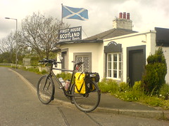
Scotland
Woo, Yay! And it stopped raining too! But who turned the wind on?
Carlisle
Couldn’t find a tea room in Penrith, so got back on my bike and rode the 15 or so miles up to Carlisle. It turned out to be some of the most enjoyable cycling yet. No navigation, A6 all the way. Big wide and pretty smooth road with very little traffic on it. I put Queen on the ipod and rode along having a blast. Only a couple of minor hills but most of it was gentle rolling countryside, gradually spending some of the elevation gained on Shap.
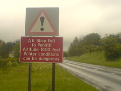
So Shap itself wasn’t as bad as i was expecting. It was good that it was early in the day. I ate so much pasta last night that i felt a bit unwell later! But it was worth it, because the strength which i lacked yesterday was back in spades today. Some extra chocolate after breakfast set me up for the climb. It was raining again as i left Kendal, but today i opted to go without rain trousers since they’re too warm. And i went for summer gloves, again because of overheating. They dry quickly if and when the rain stops. I took it easy up the first two lead-in hills, gradually warming up, but pleased to see that i was already up at nearly 300m elevation. A short downhill leads you round to face the real climb, which is easy to see because of all the lorries struggling slowly to get up the hill! It’s a steady slog to get up to the top, unlike the short steep climbs of yesterday. More akin to Cheddar Gorge than Cornwall. As i got onto the last half mile, the wind picked up and i could feel it actively helping me up the hill. I was so pleased! It was like something out of a classical greek story! A quick stop for a photo at the 425m top, where the weather was horrendous – i took a video but you can’t hear a thing because of the wind.
The descent was a lot of fun, despite the weather. You expend your elevation very gradually, and spend a lot of time at over 30mph. It continues much like that most of the way into Penrith really. I’ve found that i use the elevation feature on the gps as some kind of distance gauge – ie. I’m at 300m now so i have another 125m to go. It’s also nice to know if you’re likely to get a downhill run into town, since towns are usually built on rivers and tend to be low lying.
Given that I thought today would be one of the hardest days, it’s turned out to be not too bad and i’m having a lot of fun!
Next stop, scotland!!
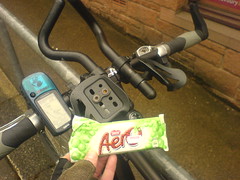
Clarification for Sarah
See, aero bars and and aero bar. Both very useful, but in different ways.
Shap, done
Woo, i’m so pleased. Wasn’t half as bad as i was expecting. Rubbish weather, but that goes without saying! On to Penrith now.


